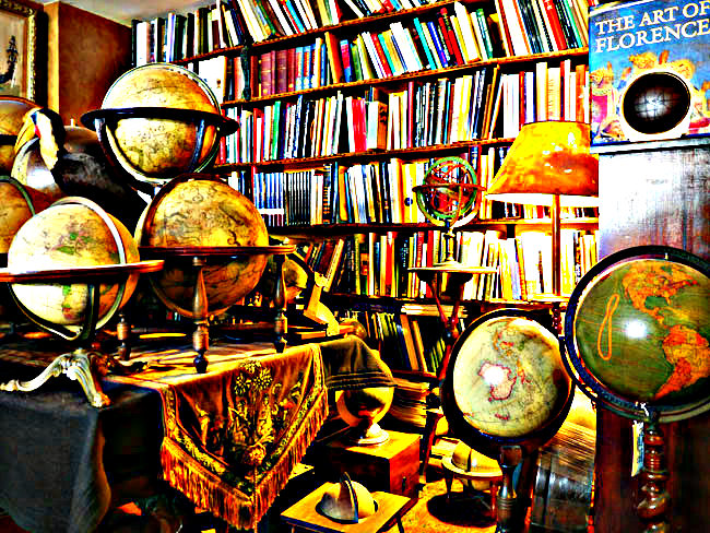
Reworking of George Glazer’s New York Globe Collection.
A Forest of Globes
It’s funny to think about now in an age of GPS, Google Maps, and basic geography lessons in elementary school. But not so long ago- the lay of the land was virtually unknown to the majority of the human population.
It was filled-in as explorers fleshed out the missing bits (neatly destroying that whole pesky ‘the world is flat’ concept and ruining the mystique of the ‘here be dragons’ urban legends). But even then, often this knowledge was a privilege of the elite and a powerful tool of mercantile forces. Ship captains and merchants guarded their maps and trade routes carefully. Lords and bureaucrats passed out geo-spatial information rarely–often keeping the earliest of maps locked away. Knowledge is power after all, and knowing where the resources are is one of the best ways to keep in control. The widespread awareness of what our world looks like is one of the most important, though often overlooked successes of ‘open access’ over the past centuries.
In fact, maps are so ubiquitous now, most people don’t realize how rare and inaccessible they were less than three hundred years ago. Imagine it: for most of the five-ish millenia of recorded human history, most people didn’t know what was beyond the next mountain range unless they’d been there themselves, let alone what was happening a continent away. We live in privileged times of global awareness.

Open Access Antiquarian Ashley M. Richter with art historian Katharina Giraldi-Haller and art diagnostician Maurizio Seracini after laser scanning the Palazzo Vecchio Mappa Mundi and Hall of Geographical Maps in Florence, Italy.
Take for instance the Hall of Geographical Maps in Florence’s Palazzo Vecchio (recently surveyed by Open Access Antiquarians Ashley M. Richter (that’s me!) and Vid Petrovic). One of the largest known historical collections of cartographical knowledge, this Renaissance repository is easily visited by tourists now. But when these maps were first created only a few centuries ago, only a rare few would have been able to even see its inlaid cabinets of detailed maps and central Mappus Mundi (one of the largest extant globes of the earth). This room was one of the Medici strongrooms, and the cabinets behind the maps would have once contained treasures which, like the maps, were kept away from prying eyes and sticky fingers.
Reworking of George Glazer’s New York Globe Collection.
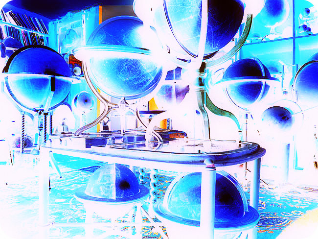
To celebrate this on-going triumph of open access awareness (and arguably antiquarianism), within the proposed Cabinet of Curiosities art show, we’d like to include a cartographic forest of globes: light up globes, darkened globes, big globes, little globes, make your own globes, augmented globes, virtual globes, real globes, etc…
But our mix of re-purposed manufactured globes, digital maps, and hand-made globes won’t just be representative of the temporal nature of maps, i.e. modern maps vs. historical maps. It’s also going to hit on two other topics near and dear to our ink-stained hearts.
We’d like to explore the technologies of cartography with this piece- the construction of maps throughout time–hand drawn through to aerial imaging from space.
A Woodland of Imaginary Places
And, we’d like to move beyond the here and now of the known ‘real’ world and look at other forms of cartography. We’d like to mix it up and move away from strict science and mathematical scales to look at the more philosophical and existential notions of real and imagined geographies of time and space. Not just on this world, but in all of the delightfully fictional worlds of science fiction and fantasy.
When authors create spaces, and build worlds with their literary sub-creating, they are in essence performing archaeology backwards. They are reverse engineering their plot-points into built society and spatial reasoning around their stories. Whereas us poor archaeologists, have the remains of society and spatial reasoning, and only the rarest of hopes to have enough tales to stretch between them. In fleshing out the past, there is a certain blend of science and imagination that connects the dots–and in dappling our glade of curios with groupings of lit up globes of modern, historic, and imagined cartographies, we’d like to emphasize the analytical whimsy that goes along with any kind of interpretive storytelling of fact and fiction.
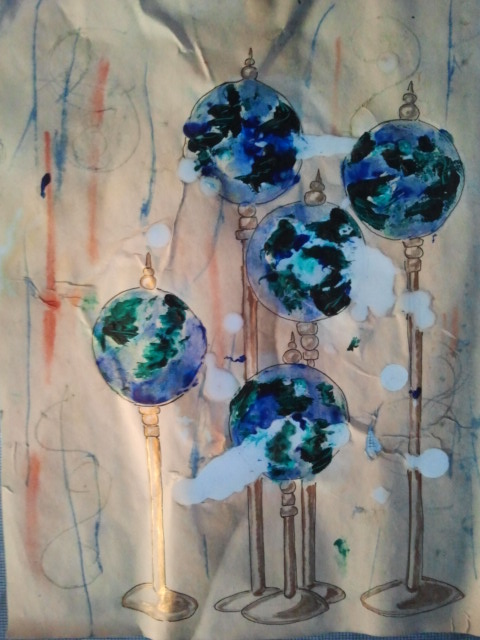
An experiment in wax sketch of the imaginary globe forest.

Reworking of Erik Desmazières etching “La salle des planètes (The hall of planets).”
